Through the generosity of St Francis Cycling Club members, the St Francis MTB Loop has been extended during the last two years from about 22km to about 27km, with the percentage off-road about 50% compared with about 30% on the old route. All the track extensions that have been built are offroad.
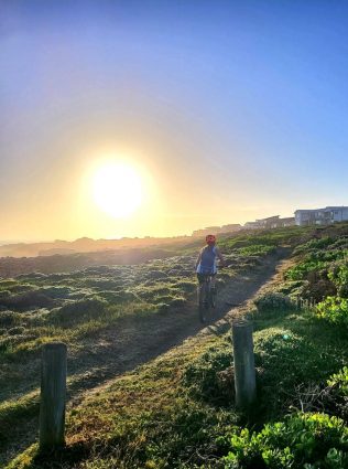
The new route includes two wonderful new beachfront sections, Bruce’s and Otters Landing.
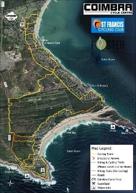
Signage has been added, and a decent map produced. The new route has been widely praised, but we plan to continue upgrading it until it is well known nationally.
We have worked extensively with two NGO’s whose areas of jurisdiction our route crosses, Kromme Enviro Trust and Foster, and built good relationships with them.
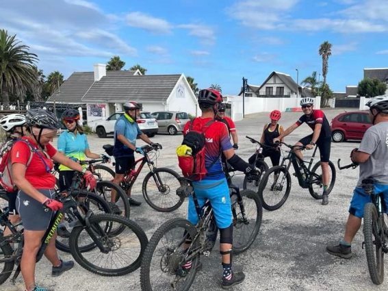
Our local municipal councilor, Lorraine Maree is on the committee, and helped whenever she can. The new owners and management of the local shop, Coimbra Cycle Centre, have enthusiastically joined our club committee, with manager Morne Knoetze taking over responsibility for the Thursday evening club rides.
Greg West and Tryone Kindness have been at the coalface of the track building and maintenance. Huge thanks to them.
The plan for this year is to focus on track maintenance, much of which has already been done, with some good ideas for some new sections, with the emphasis on reducing the percentage of tar.
There are other great routes in the area eg low tide to JBay, but the club’s main focus is the maintenance and improvement of our local loop.
It’s only R300 pa to join: St Francis Cycling Club, Standard Bank 186519508. Then send me a WhatsApp on 0832840168 so I can add you to the group.
Thanks to members for the photos!
The route until 2019 was as follows :
From Quays (on the canals), on tar all the way down St Francis Drive to the very end, then onto the gravel road for about 100m, then sharp right onto the single track through the nature area for about 2km. (Sometimes we cycled via the Port and Otters Landing)
Then onto the tar in Cape St Francis, via Shearwater Drive, and all the way along da Gama Road, until a path onto the main beach gravel carpark.
Through a shortcut path to Lyngenford Road, down to Seal Point Boulevard via President Reitz, along the track around the lighthouse to the tar Queen of West boulevard (there were no dedicated cycle tracks).
Up Bende Lane, left into St Francis Way for about 200m, across the lawn at the entrance to Cape St Francis, onto the track that follows the route of the old road for about 1km, down the steep Full Stop hill … and back the same way, as you came.
The loop from the Full Stop around the lighthouse was done ant-clockwise, especially in a stiff westerly!
The old route was about 22km. Not sure if anyone broke 60min? I did it in 61min once, so Roland and crew could have broken 50min quite easily!
The current route is as follows:
Start at the Coimbra Cycle Centre (although Thursday evening rides start at Quays), and winds through the streets between St Francis Drive and the sea, until the bottom of Harbour Road, where we have the new spectacular Bruce’s section.
Then via Santareme streets back to St Francis Drive. After about 100m, the route is onto a track for about 1km parallel with the road, back onto St Francis Drive for about 500m, and left down Triton Drive to the Port.
Through the “gap” onto the single track in front of Otters Landing, and along the short soft sandy beach, up the gravel road, and onto the old route (the single track through the nature area)
Then through quieter (than the old route) higher tarred roads in Cape St Francis, back onto da Gama Road, and up the steep hill at the Full Stop Café, onto the track which follows the old road for about 200m, then through the Irma Booysen Reserve to Diaz Crescent, a right back into da Gama, and back into the Irma Booysen at the tennis courts.
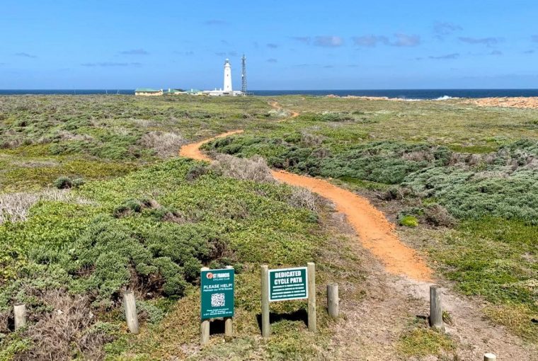
Then via the St Francis Way to President Reitz Road, where it follows the old route around the lighthouse (except for the dedicated cycle track of about 1km) and back to the top of the Full Stop hill, but then left through the bush for about 200m to the R330 (instead of descending to the right).
The route then follows the R330 for about 2km, with about 70% being single track on the right, just off the road.
Sharp right to the old rubbish dump, and slide left after about 200m on single track into the Thatch Farm area (where we have lost about 500m due to the dams caused by rain about a year ago).
Then onto the 500m gravel road, left at St Francis Drive onto a track on the left of the road, and onto the tar back to the start.
Posted by The Know - Pam Golding Properties


